Working Hours: 9:00 AM to 9:00 PM
Home / Services

Our CAD Drafting Services

Comprehensive CAD drafting solutions for residential, boundary, commercial, and land surveying projects across the United States.

Residential Focus

Residential Survey Drafting Services

Accurate CAD Drafting for Residential Land Surveying Projects

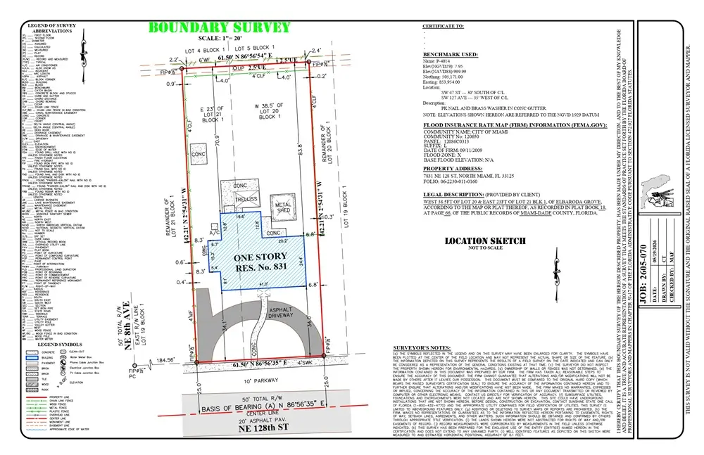
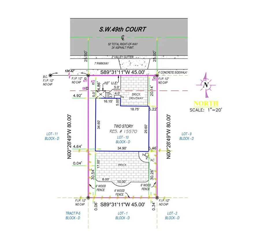
Every residential development begins with a clear understanding of the land. At CAD TECHNO, we provide professional residential survey drafting services that help land surveyors and surveying companies turn field data into accurate, well-organised CAD drawings.

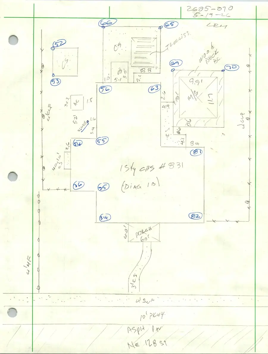
Our team works with survey measurements, field notes, property boundaries, and other survey information to prepare detailed residential survey drawings. We focus on presenting every important detail clearly, helping surveyors review site conditions, understand property layouts, and move forward with their projects confidently.

Whether it is an individual residential property, a new housing development, or a small subdivision, we provide reliable CAD drafting support tailored to your project requirements.

Our Services

Our Residential Survey Drafting Includes:
Boundary and Property Surveys
Lot and Block Surveys
Subdivision Drafting
Topographic Survey Drafting
Existing Conditions Surveys
Residential Site Plans
Residential Survey Drafting Sample
Boundary Retracement

Boundary Survey Drafting

Accurate Property Boundary Drawings for Reliable Land Surveying

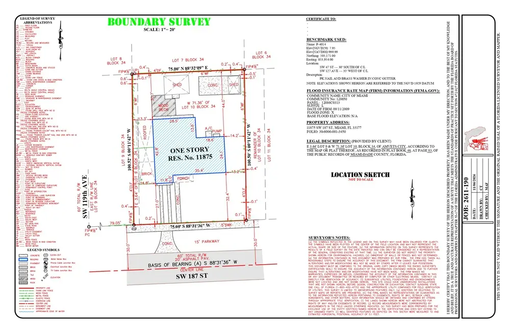
Boundary surveys play an important role in identifying property limits, establishing land ownership boundaries and understanding the exact dimensions of a parcel of land. They help determine property corners, boundary lines, easements, rights of way and possible encroachments that may affect the use of a property.

At CAD TECHNO, we provide professional Boundary Survey Drafting Services to help land surveyors and surveying firms convert field data, survey measurements and property records into clear, detailed and well-organized CAD drawings.

Our drafting support includes accurately representing property boundaries, adjoining parcels, existing structures, utility easements, access rights and other important site details. We focus on maintaining drawing accuracy, consistency and clarity so survey professionals can review and use the drawings for their project requirements.

Our Services

What Our Boundary Survey Drawings Include:

Property Boundary Lines
Property Corners
Easements and Rights of Way
Encroachment Details
Adjacent Property Information
Site Features
Boundary Survey Drafting Sample
Title & Closing

Mortgage Survey Drafting Services

CAD TECHNO provides professional Mortgage Survey Drafting services to support surveyors, mortgage companies, lenders, title companies, and real estate professionals. We convert field survey data, property measurements, legal descriptions, and site information into clear, accurate, and well-organized CAD drawings.

A mortgage survey helps identify the property boundaries, building locations, visible improvements, easements, and other features relevant to a property transaction. Our drafting team prepares detailed 2D CAD drawings based on the survey information and documents provided by clients.

With a focus on accuracy, consistency, and timely delivery, CAD TECHNO helps surveying professionals manage their drafting requirements and deliver reliable survey drawings for mortgage and property documentation.

Our Services

Mortgage Survey Drafting Services We Offer:

Property Boundary Drafting
Building Footprint Drafting
Easement and Setback Drafting
Visible Improvements Drafting
Utility and Access Information
Final CAD Drawing Preparation
Mortgage Survey Drafting Sample
Subdivision Plats

Professional Lot & Block Survey Drafting Services

Accurate Lot & Block CAD Drawings for Property Documentation

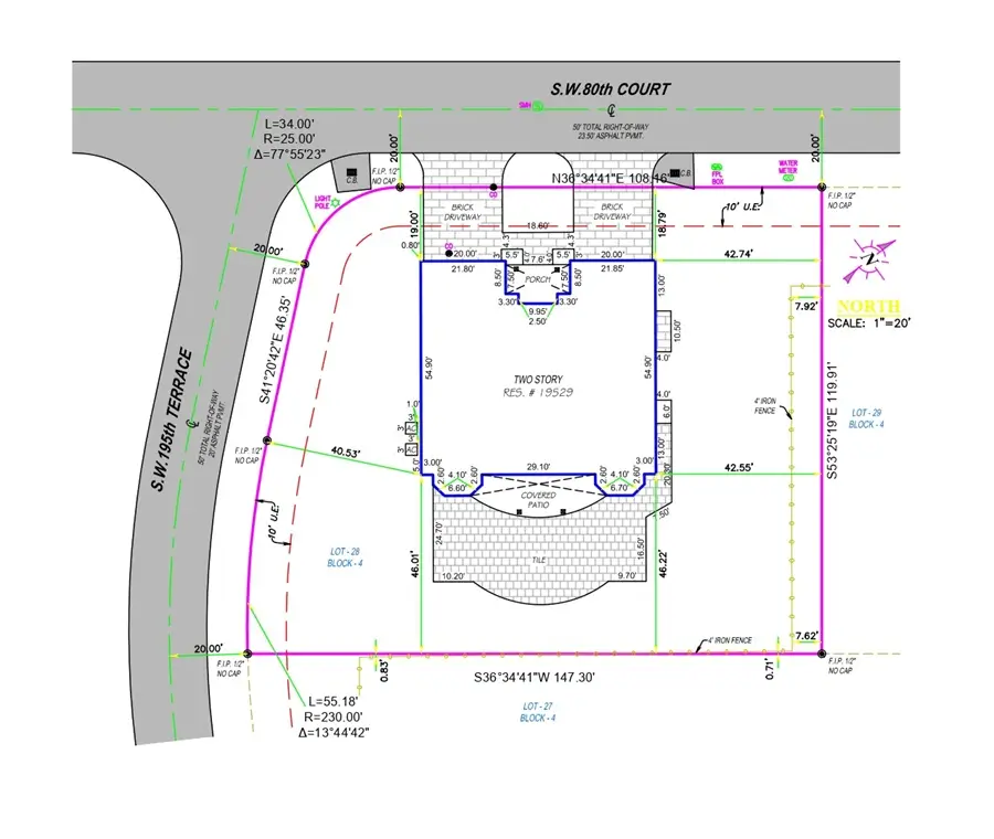
CAD TECHNO provides professional Lot & Block Survey Drafting Services to help land surveyors, engineering firms, and property professionals prepare clear and accurate property survey drawings. We work with field notes, recorded plats, legal descriptions, survey data, and other project documents to create well-organized CAD drawings.

Our drafting team focuses on accurately representing property boundaries, lot dimensions, block layouts, easements, rights of way, and other important property details. We prepare detailed 2D CAD drawings that are easy to review, edit, and use for further surveying and land development work.

Whether it is an individual residential lot or a large subdivision layout, CAD TECHNO delivers reliable drafting support with attention to detail, consistent quality, and timely project delivery.

Our Services

Lot & Block Survey Drafting Services We Offer:

Lot Layout Drafting
Block Layout Drafting
Subdivision Plat Drafting
Property Boundary & Dimension Drafting
Easement & Right of Way Drafting
Existing Plat Conversion & Revisions
Lot and Block Survey Drafting Sample
Undeveloped Acreage

Vacant Lot Survey Drafting Services

Accurate Vacant Lot Survey Drafting for Clear Property Documentation

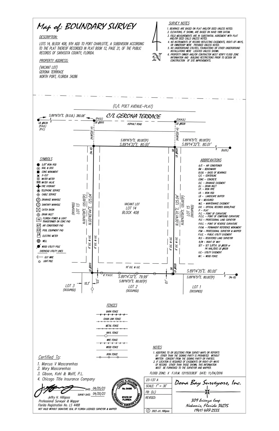
Vacant lot surveys play an important role in understanding the boundaries, dimensions and existing conditions of undeveloped land. Before a property is developed, divided or prepared for construction, accurate survey drawings help identify property lines, lot dimensions, easements, access points and other important site details.

At CAD TECHNO, we provide professional Vacant Lot Survey Drafting services to help land surveyors and surveying companies convert field data, survey measurements and project information into clear, detailed and well-organized CAD drawings.

Our drafting team works with the information provided by clients to prepare accurate 2D CAD drawings that make vacant land details easier to review, understand and use for further planning and development.

Our Services

Vacant Lot Survey Drafting Services We Offer:

Vacant Lot Boundary Drafting
Lot Dimension and Area Drafting
Easement and Right of Way Drafting
Existing Site Feature Drafting
Lot Layout and Subdivision Drafting
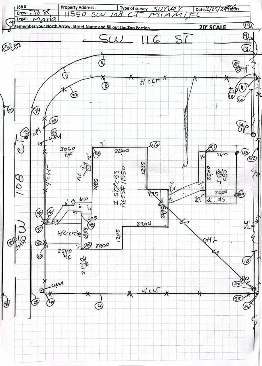
Survey Plan Cleanup and CAD Conversion
Vacant Lot Survey Sample
Site Permitting

Plot Plans Drafting Services

Professional Plot Plan Drafting for Clear and Accurate Site Layouts

A plot plan provides a clear visual representation of a property, showing its boundaries, buildings, structures and other important site features. It helps property owners, architects, builders and construction professionals understand how a property is arranged and how different elements are positioned within the site.

At CAD TECHNO, we provide professional Plot Plan Drafting Services to prepare detailed and well-organized CAD drawings based on supplied survey data, field notes, measurements and project documentation.

Our drafting team focuses on presenting property information in a clear, accurate and easy-to-understand format. Whether it is a residential property, commercial site or construction project, we create CAD plot plans that support planning, documentation and project requirements.

Our Services

Plot Plan Drafting Services We Offer:

Residential Plot Plans
Commercial Plot Plans
Property Boundary and Dimension Plans
Building Location Plans
Driveway and Parking Layout Plans
Utility and Easement Plans
Plot Plans Drafting Sample
Environmental & Preservation

Tree Location Survey Drafting Services

At CAD TECHNO, we provide professional Tree Location Survey Drafting Services to help land surveyors, engineering firms, architects, and developers represent existing trees accurately within their site plans.

Using field survey data, measurements, and supplied project information, we prepare clear and well-organized CAD drawings showing tree locations, tree identification numbers, trunk positions, canopy spreads, and other relevant details.

Our drafting approach focuses on accuracy, clarity, and consistency, helping professionals understand existing site conditions and make informed decisions during planning, design, and development.

Our Services

Tree Location Survey Drafting Services We Offer:

Tree Location Mapping
Tree Canopy and Trunk Details
Tree Identification and Numbering
Tree and Site Feature Mapping
2D CAD Tree Survey Drafting
CAD Drawing Cleanup and Formatting
Tree Location Survey Sample
General Land Survey

General Land Survey CAD Drafting

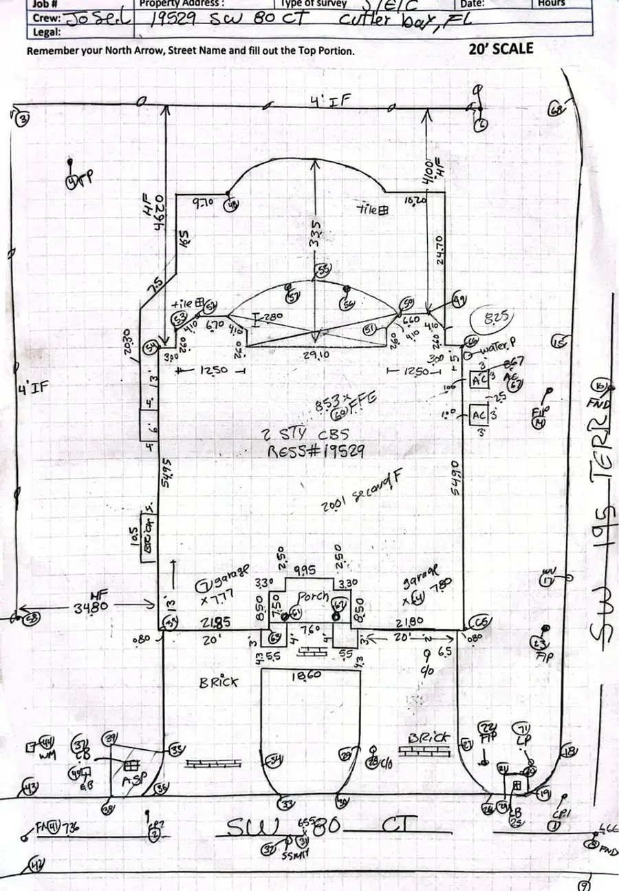
CAD TECHNO provides professional General Land Survey CAD Drafting Services to support land surveyors, surveying companies, engineering firms, and construction professionals. We convert field survey data, measurements, sketches, and survey notes into accurate, detailed, and well-organized CAD drawings.

Our drafting team focuses on preparing clear land survey drawings that represent property boundaries, existing site conditions, topographical details, improvements, and other important land features. We help surveying professionals manage their drafting workload while maintaining drawing accuracy, consistency, and timely project delivery.

Our Services

General Land Survey CAD Drafting Services We Offer:

Boundary and Property Line Drafting
Topographic Survey Drafting
ALTA/NSPS Land Title Survey Drafting
Residential Land Survey Drafting
Commercial Land Survey Drafting
Subdivision and Lot Survey Drafting
Site Plan and Existing Conditions Drafting
Utility Survey Drafting
Easement and Right-of-Way Drafting
As-Built Survey Drafting
General Land Survey CAD Drafting Sample

Need Reliable Survey Drafting Support?

Let us handle your CAD drafting requirements with accuracy, professionalism and timely delivery.